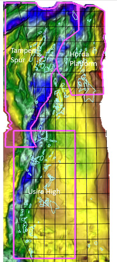
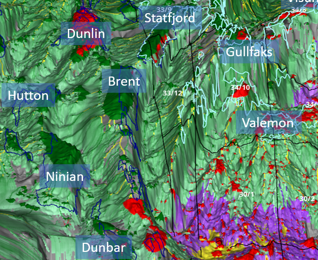
New studies in the North Sea
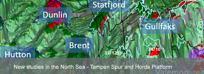
We are pleased to announce the completion of two new high-resolution 3D charge modelling studies in the North Sea; the Horda Platform Charge Atlas and the Tampen Spur Charge Atlas. These new multi-client studies follow up on the Utsira High Charge Atlas study, which was completed earlier this year.
Basis for studies
The Charge Atlas models build upon our North Sea Charge study from 2013. The depth models have been constructed using input from the PGS MegaSurvey and Digital Atlas interpretations. Burial, maturation, generation, migration, and leakage were dynamically modelled through time in each realisation of the full 3D basin model. The modelling results include predictions of the probabilities of charge, phase and hydrocarbon trapping for the main carrier systems.
Probabilistic approaches
Probabilistic approaches have been applied in the numeric description of the source rock models, in the thermal history, hydrocarbon generation, migration and leakage modelling. Important parameters such as the temperature field, lithologies and source rock properties are all described using a combination of maps of most likely values and uncertainties.
The models are calibrated against a database containing several hundred hydrocarbon column observations at different carrier levels. An iterative stochastic modelling procedure is used to improve the model fit to the observation data. The approach allows for estimating uncertainties in the modelling results by weighting the compiled results from a large database of simulation runs against the observation dataset. Based on this calibration procedure, “best fit” migration models in each of the study areas have been deduced.
Modelling results
The main results from the modelling are documented in the Charge Atlas reports, which contain a series of high-resolution output maps and discussion of the findings. The maps contained in the Charge Atlas are also delivered as a set of grid files at 200 m resolution. The grids can be loaded into standard interpretation software for use in the day-to-day exploration work. The “best case” migration simulations are also made available as interactive 3D animations.
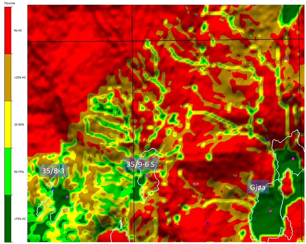
Important results from the modelling include:
- Maturity maps (transformation/HC windows/timing)
- Generated oil and gas volume maps
- Flowrisk maps showing risk of charge
- Phaserisk maps showing probability of oil phase
- P10, P50 and P90 hydrocarbon column heights
- Best case migration histories
The results from this project will provide insights to understanding the overall hydrocarbon charge systems and petroleum systems risks in the area. The charge risk maps will be useful for highlighting targets. The maps will be valuable input to e.g. farm-in evaluations and license application screening.
The new Charge Atlas studies are available for purchase from December 2017. Special upgrade prices for existing clients of the North Sea Charge study are available. Please contact us if you are interested in a presentation or an end-of-year discount offer.
PDF leaflet about the Horda Platform Charge Atlas study:
PDF leaflet about the Tampen Spur Charge Atlas study: